
Rails to Relics:
Utah’s Fading Frontier

In Utah’s inhospitable West Desert, the archaeological remains of one of the most ambitious engineering projects in U.S. history stand as a silent testament to those who made it possible.
But now that legacy is under threat.
LX Heritage is launching an ambitious new project to preserve the archaeology of the First Transcontinental Railroad between Promontory Summit and the Nevada border to ensure this part of history, and everything it teaches, will not be lost to future generations.

Under Threat
The remote nature of the West Desert means that the heritage there is difficult to protect. While the inaccessibility reduces exposure to large crowds, it also reduces the ability of heritage professionals to monitor the vast historic byway. Artifacts are frequently taken by visitors, and features, such as interpretive signage, and even grave markers, are used for target practice.
The heritage in the West Desert now faces an immediate threat. The Great Salt Lake, the ecological foundation for Northern Utah, has already lost half of its footprint due to overuse and human-driven climate change. In 2023, scientists at Brigham Young University estimated that, without intervention, the lake would completely dry up by 2028. This would spell environmental disaster for the region, and would make the heritage of the First Transcontinental Railroad in the West Desert inaccessible for future generations.
-
Because of the remote nature of the site, continuous monitoring by heritage professionals is virtually impossible. Artifacts are frequently moved or taken by visitors to the backcountry, and the popularity of target shooting has often meant the destruction of features throughout the 88 miles of railroad grade.
-
In 1987, the Great Salt Lake occupied about 3,300 square miles. By July, 2022, the lake only occupied about 950 square miles. Scientists say the West is as dry as it has been in 1,200 years, and upstream diversions of water for agricultural use, as well as a recent population boom, are all contributing to the loss of the lake.
-
The water of the lake currently traps large amounts of toxic materials in the soil beneath it. As more of the lake bed is exposed and dries up, substances like arsenic and lead become exposed to the air. Dust from the exposed lake bed then carries these toxic elements, among others, throughout the region. The section of the First Transcontinental Railroad is close enough to the lake bed that the loss of the lake could result in impenetrable clouds of toxic dust that prohibit access to this heritage.
-
As the lake continues to dry up, it is emitting increasing amounts of carbon dioxide, further driving climate change. Over a seven-month period of research during 2020, scientists discovered that the drying lake emitted 4.1 million tons of carbon dioxide and other greenhouse gases into the atmosphere, increasing Utah's human-caused emissions by 7%.
The Project
-
Survey
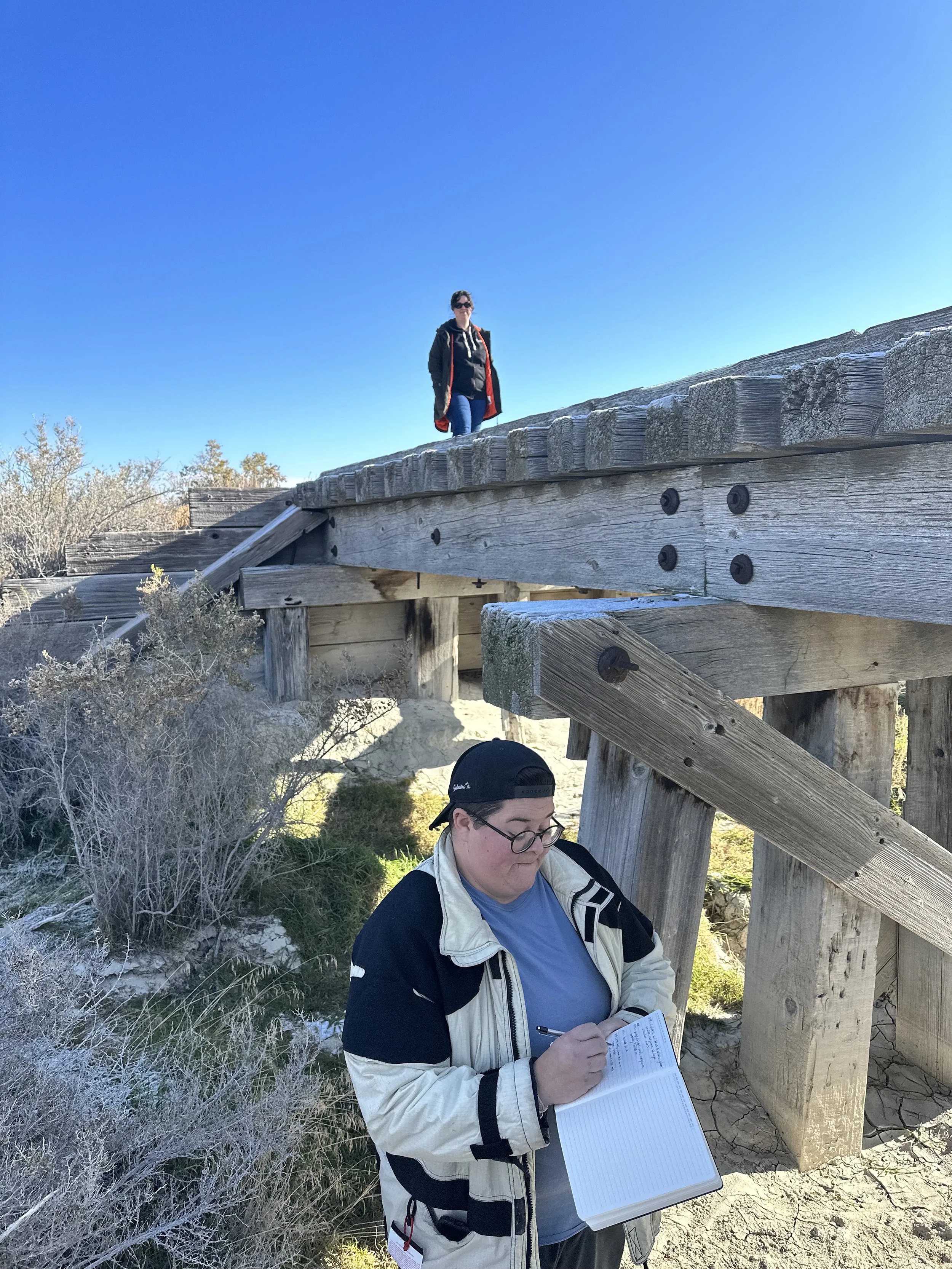
Our team of archaeologists will perform pedestrian surveys of the entire 88 miles of the right of way of the First Transcontinental Railroad between the Nevada border and Promontory Summit. This will ensure that no piece of heritage goes overlooked.
-

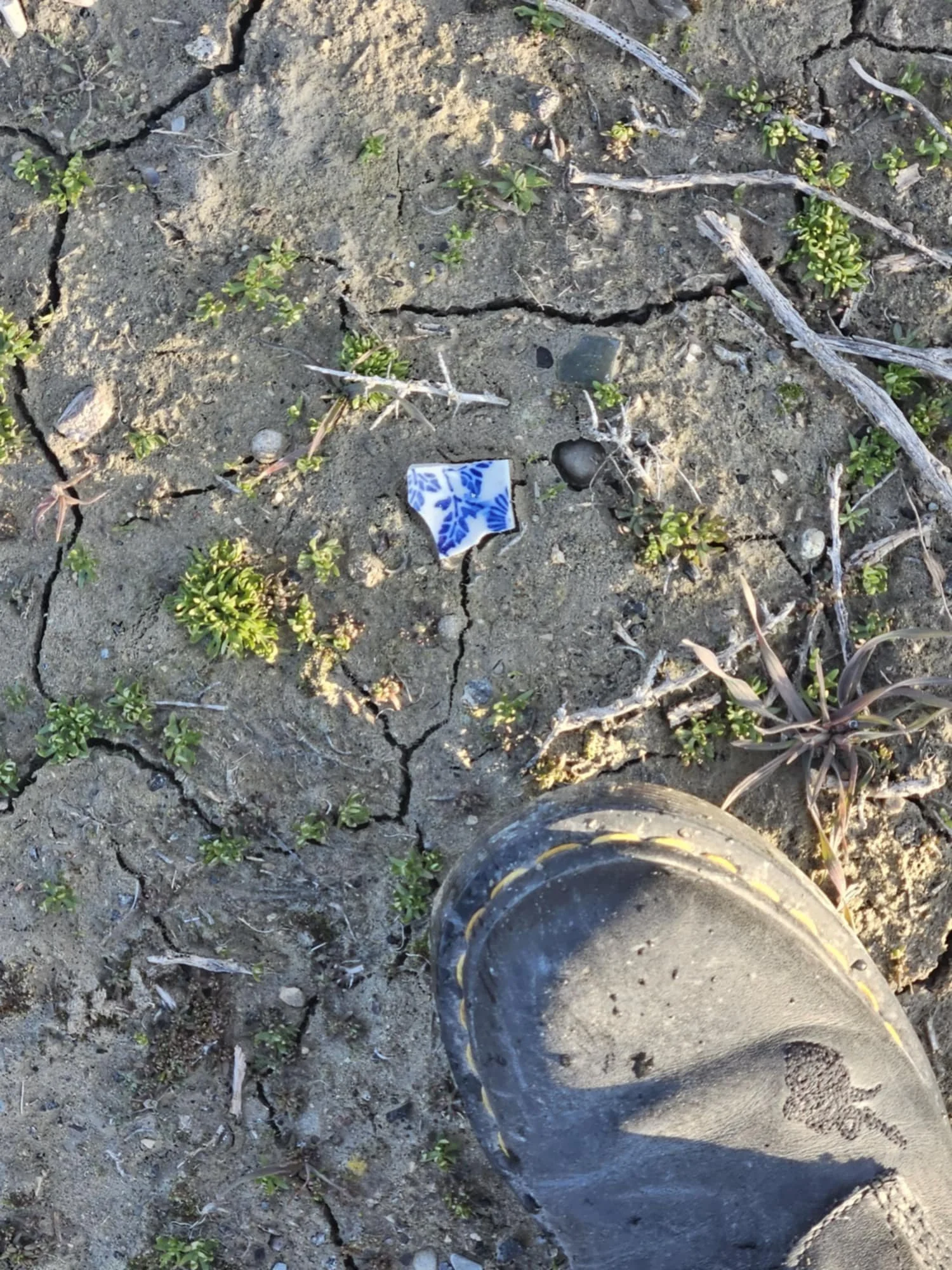
Documentation
Thorough documentation will be made of every piece of heritage identified through pedestrian surveys, from small pottery shards to foundations of buildings. This will serve as an accurate record of the archaeology of the railroad as it exists now, and will be available for all future scholars to study.
-

Modeling
Using UAV technology, we will create 3D photogrammetric models of the entire First Transcontinental Railroad grade in the West Desert. This will ensure the digital preservation of the heritage in the face of an uncertain future, and will serve as the basis for publicly accessible interpretive material to ensure this heritage will continue serving future generations.
-

Accessibility & Awareness
The research we conduct in the West Desert will be used as the basis for multiple future programs aimed to guarantee access to the history and lessons represented by the First Transcontinental Railroad. This will include a digital heritage trail, museum exhibits, and educational curriculum.
Our efforts will also spread awareness of the importance of environmental stewardship by highlighting the plight of the Great Salt Lake.
The Iron Road
Completed in 1869, the First Transcontinental Road was a watershed moment in United States history. A journey that had previously taken months, money, and manpower could now be taken in a matter of days as the western half of the continent was connected to the east. Called “the iron road” by Chinese railroad workers, this ambitious engineering project ran from California to Iowa, spanning plains, mountains, and deserts. After four years, and with the driving of the final spike, over 1900 miles of continuous track had been laid.
The bulk of the railroad was constructed by two companies, each starting at opposite ends and meeting at a predetermined location in the middle. The Union Pacific Railroad (UPRR) began in Iowa and built west, while the Central Pacific Railroad Company of California (CPRR) began in Sacramento and built east.
The chosen meeting point was Promontory Summit in Utah Territory, roughly 50 miles northwest of modern-day Ogden, which would eventually become the key interchange of the two railroads.
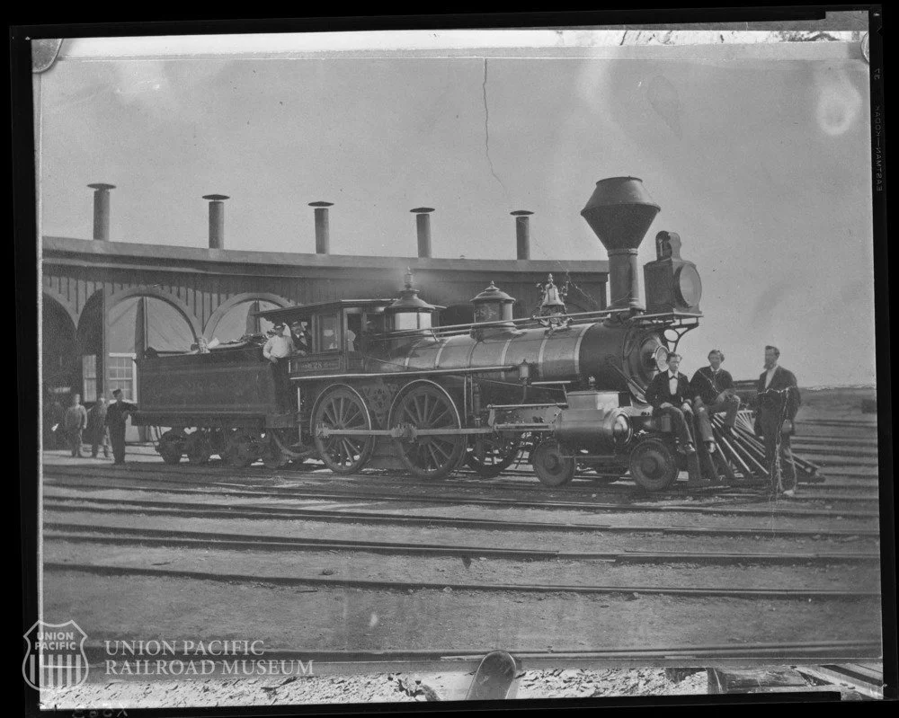
A locomotive at the roundhouse in Terrace, Utah, in 1873. Terrace is now one of the ghost towns along the rail grade in the West Desert. Image from the Union Pacific Railroad Museum Archives.
East to Promontory
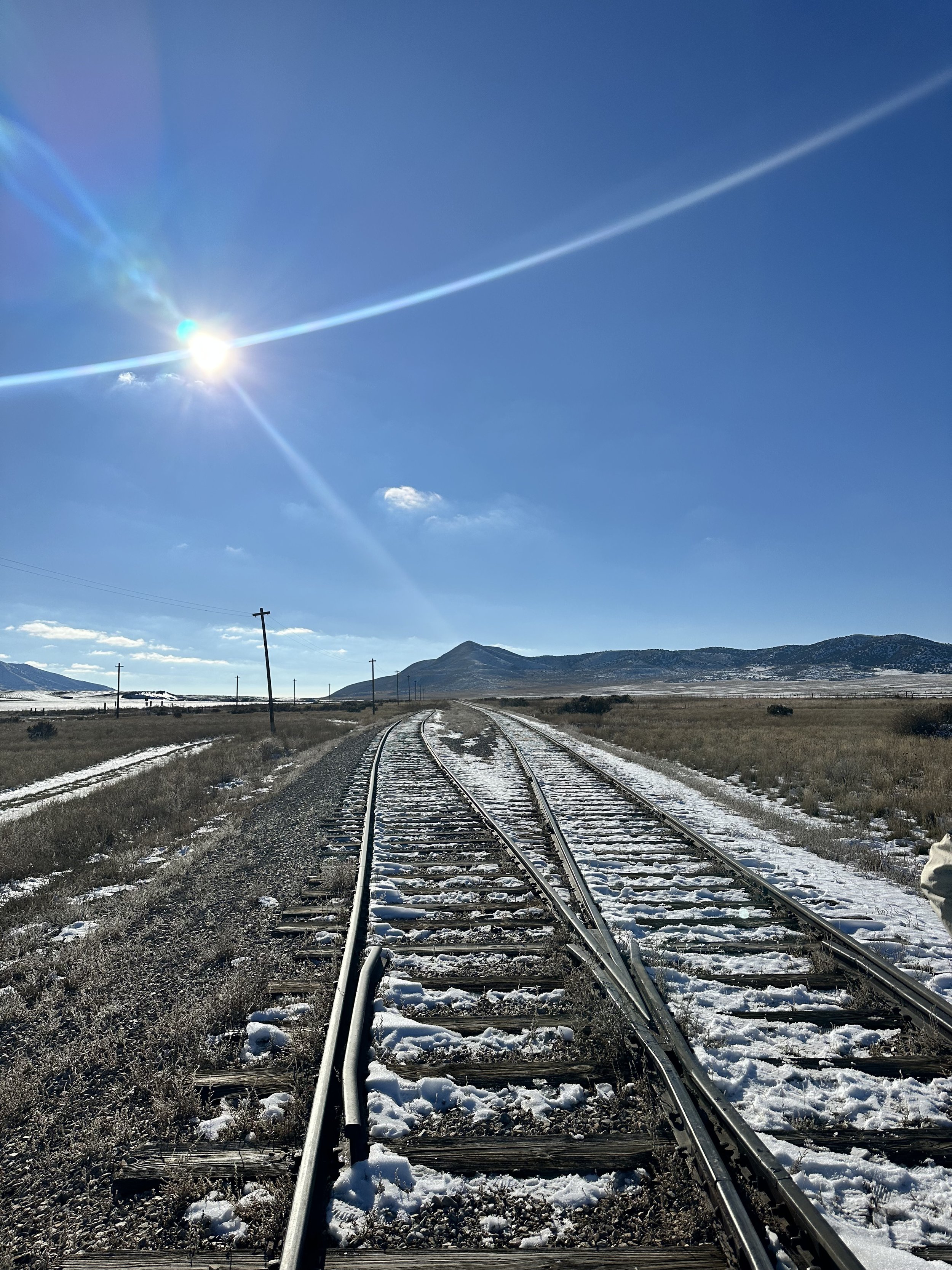
For the CPRR, finishing at Promontory Summit meant roughly 90 miles of construction in Utah’s harsh West Desert, and all this after crossing the deserts of Nevada and the punishing Sierra Nevada mountain range. The sharp turn north, and thus the amount of track in the West Desert, was necessitated by the Great Salt Lake lying directly in the path of the planned railroad. Because it wasn’t possible, yet, to go across the lake, the CPRR workers would have to go around it.
Every 15 Miles
One of the most difficult obstacles for the CPRR laying track in the West Desert was planning access to water. A steam locomotive in this era required access to fresh water every fifteen miles, something that was hard to come by in the landscape surrounding the Great Salt Lake.
The End of an Era
Prior to the settlement of the Utah Territory by white emigrants, the West Desert was part of the territory of the Northwestern Band of Shoshone, part of a larger group of Shoshone people that lived throughout Utah, Idaho, Wyoming, and Nevada. The Shoshone were highly mobile, and spent each season in different parts of their territory in order to optimize the resources they collected from hunting, gathering, and fishing. In the 1840s, Anglo settlers using the California and Oregon trails began to cross Shoshone lands, and in 1847, the arrival of the first wave of permanent emigrants from the LDS Church began a period of resource competition, territory reduction, and violence for the Shoshone.
In 1863, just two years before construction commenced on the railroad, this period of tension culminated in the Bear River Massacre. Over the course of four hours, a group of about 200 army volunteers killed 350 Shoshone camped on the banks of the Bear River. After the massacre and the loss of so much territory, the Northwestern Shoshone could no longer maintain their traditional nomadic lifestyle. White settlers were able to move further into Shoshone territory without opposition, setting the stage for the boom of white settlements stemming from the construction of the railroad.
The lack of abundant freshwater and the composition of the soil in the West Desert meant that this area was not suitable for farming, and so, by the time the CPRR began construction, there were no Anglo settlements. But, as the railroad made it’s way east, and finally made the turn north to skirt the Great Salt Lake, that all changed.
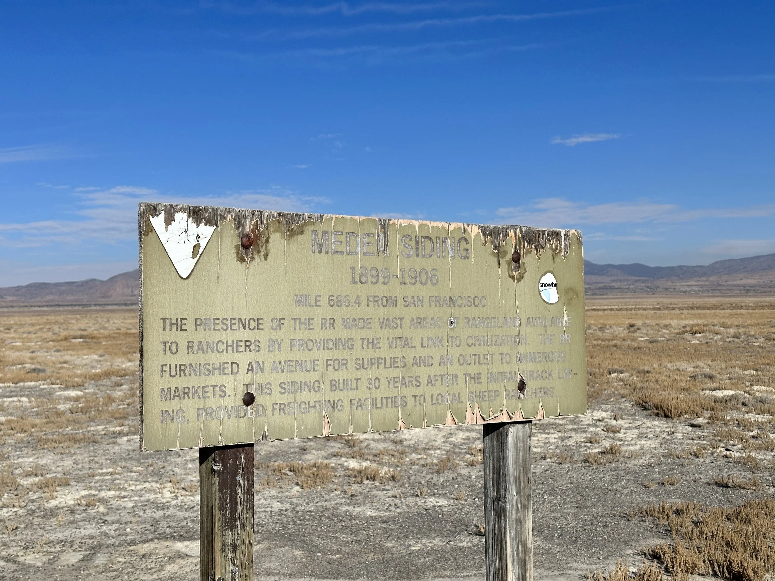
Large construction camps moved with the railroad, leaving in their wake the facilities required to service the locomotives every 15 miles, and the beginnings of the towns that would soon dot the Iron Road.
The opening of the Lucin Cutoff in 1904 drastically changed this region once again. A causeway was built by the Southern Pacific Railroad to cross the Great Salt Lake and shorten the railroad by bypassing the route the railroad had originally taken around the north side of the lake. When the railroad stopped running through this part of the West Desert, many of the towns that had sprung up in the wake of its construction and that relied upon it for survival began to decline.
Today, the remnants of the construction camps, the abandoned towns and their cemeteries, and the various artifacts associated with the people who once lived there, have all become part of the archaeological record of the West Desert.
The CPRR Chinese Railroad Workers
12,000 Chinese immigrant railroad workers made possible the entire western section of the First Transcontinental Railroad. The racial prejudice they faced greatly impacted their lived experience working on the railroad, as well as the information that is now available for scholars to use to study this period. Of the groups working on the railroad, the lives, and deaths, of the Chinese railroad workers were the least documented. Luckily, filling in gaps in the historical record, especially those resulting from historical bias, is where archaeological research can shine the brightest.
While the historical record may be able to tell us basic information, like work schedules, wages, and injuries, archaeological research in the West Desert can tell us much, much more.